GPS surveying has revolutionized the way land surveyors measure and map the world. By combining precision, efficiency, and cutting-edge technology, GPS tools have made even the most complex projects more manageable.
However, success in modern surveying demands more than just the latest equipment. It requires mastery of best practices and awareness of emerging trends.
Understanding GPS Surveying
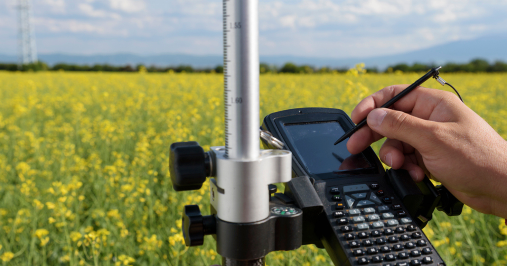
GPS surveying uses satellite technology to measure and map land. Instead of relying on manual tools, GPS surveyors gather data through signals from satellites orbiting Earth. This allows them to calculate distances, boundaries, and elevations quickly and accurately.
GPS surveying relies on three main components: satellites, receivers, and signal triangulation.
- Satellites: GPS satellites orbit the Earth, sending signals that include their location and the exact time the signal was transmitted.
- Receivers: Surveyors use GPS receivers on the ground to pick up these signals. By connecting to multiple satellites, the receiver determines its exact position on Earth.
- Signal triangulation: The receiver calculates its position using data from at least four satellites. This process measures the time signals travel from satellites to the receiver to pinpoint the location.
Modern GPS surveying equipment often integrates advanced features like multi-frequency receivers, which improve accuracy by capturing signals across different bands. These tools are designed to work in various environments, from open fields to dense urban areas.
Accuracy of GPS Surveying
The accuracy of GPS surveying depends on several factors.
- Atmospheric conditions: Heavy rain, fog, or solar activity can interfere with satellite signals. Surveying during clear weather or using signal correction techniques like real-time kinematic (RTK) adjustments will improve reliability.
- Equipment quality: High-quality GPS receivers (like those equipped with multi-frequency capabilities) are better at handling challenging environments and minimizing errors.
- Surveying techniques: Proper setup and techniques play a big role in accuracy. For instance, placing the receiver in an open area free of obstructions improves satellite visibility. Techniques like differential GPS (DGPS) or post-processing further refine data for precise results.
Best Practices for Using GPS Surveying

Success in GPS surveying starts with a solid foundation. Choosing the right equipment and following proven methods provides accurate results and efficient workflows.
Choosing the Right Equipment
Selecting the correct GPS surveying equipment is critical to completing your project efficiently and accurately. Different tools are suited to specific applications, and understanding their capabilities helps you make informed decisions.
- Real-Time Kinematic (RTK): Ideal for tasks requiring immediate, high-precision results. RTK systems use corrections from base stations to provide centimeter-level accuracy in real-time.
- Static GPS: Best for large-scale projects or areas with limited satellite coverage. This method involves collecting data over an extended period and processing it later for higher accuracy.
- Global Navigation Satellite System (GNSS): GNSS receivers go beyond GPS by accessing additional satellite networks, especially in challenging environments like forests or urban areas.
Read the following guides for more information:
Optimizing Surveying Accuracy
Maximizing accuracy requires attention to detail, proper preparation, and adherence to best practices.
- Calibrate devices regularly: Before starting a survey, check that all equipment is properly calibrated. This prevents errors caused by misaligned sensors or outdated settings.
- Verify proper positioning: Place receivers in open areas with clear satellite visibility to minimize obstructions from buildings, trees, or terrain. Adjust antenna angles to improve signal strength in challenging locations.
- Understand site conditions: Analyze site-specific factors, such as weather, topography, and satellite availability, to adjust your surveying approach. Using tools like real-time correction systems will help mitigate environmental impacts.
- Training and certification: Proper training in GPS surveying techniques and equipment use is essential. Certification programs provide the knowledge needed to operate advanced tools effectively and interpret results accurately.
For a deeper dive, read
Keeping Your GPS Equipment Survey-Ready and GPS Maintenance Tips to Extend the Life of Your Equipment.
Safety During Surveys
Safety is as important as accuracy in surveying to protect you and your equipment, especially when working in rugged terrains or high-traffic areas.
- High-visibility vests: Help surveyors remain visible in busy areas, reducing the risk of accidents.
- Hard hats and steel-toe boots: Protect against falling objects, uneven terrain, and other workplace hazards.
- Protective gloves and weather gear: Keep hands safe during equipment handling and ensure comfort in varying weather conditions.
For more information, check out our guides:
Future Trends in GPS Surveying

GPS surveying is evolving rapidly, driven by technological advancements and an increasing focus on sustainability and efficiency. Staying informed about these trends helps you adapt and leverage cutting-edge tools to improve your work.
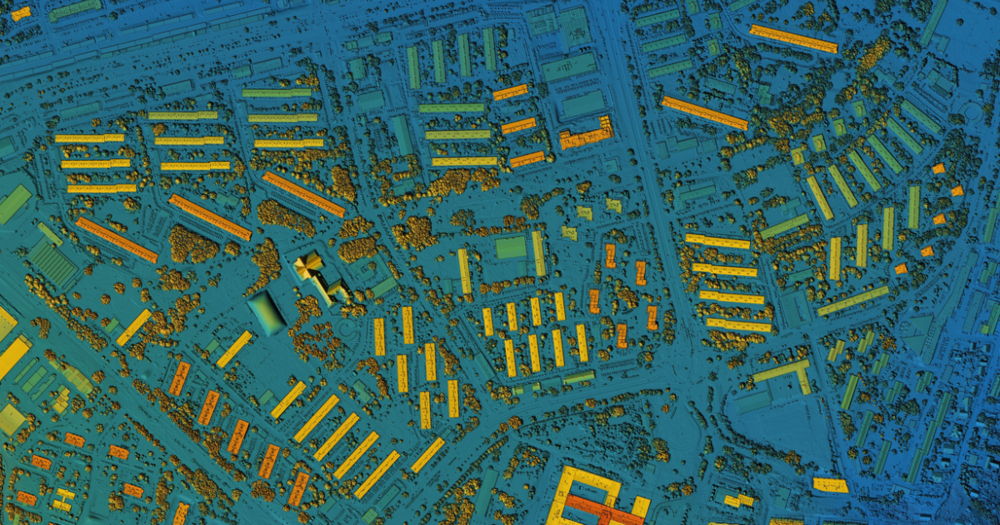
- Integrating LiDAR and GPS: Combining LiDAR (Light Detection and Ranging) with GPS systems revolutionizes land surveying. LiDAR enables highly detailed 3D mapping, while GPS provides precise geographic coordinates. Together, they deliver unparalleled accuracy for applications like topographic mapping, infrastructure planning, and forestry management.
- Advances in satellite technology:Multi-frequency GNSS receivers are becoming standard, using signals from multiple satellite constellations (GPS, Galileo, BeiDou, GLONASS) to improve accuracy and reliability. This reduces signal interference and increases performance, even in challenging environments like urban canyons or dense forests.
Automation and AI in Surveying
The integration of automation and artificial intelligence is reshaping how surveyors approach their work.
- Role of drones and automated systems: Drones equipped with GPS and LiDAR are transforming how surveys are conducted. They cover large areas quickly, collect data in inaccessible locations, and significantly reduce manual labor. Automated systems streamline processes, allowing surveyors to focus on data analysis rather than data collection.
- AI-enhanced data processing: Artificial intelligence is reshaping how survey data is analyzed. AI algorithms process large datasets more efficiently, detect patterns, and predict potential issues before they occur. This speeds up decision-making and improves the accuracy of final results, making projects more efficient from start to finish.
Sustainability and Energy Efficiency
The surveying industry is embracing sustainability to reduce environmental impact and long-term costs.
- Eco-friendly equipment: The push toward sustainability has led to innovations like solar-powered GPS devices, which reduce reliance on disposable batteries and external power sources. This lowers costs and minimizes the environmental footprint of surveying operations.
- Reducing environmental impact: Advanced tools now allow for less intrusive surveying methods, preserving natural habitats and reducing the disruption caused by traditional equipment. Lightweight, energy-efficient designs make transporting equipment easier, further reducing fuel consumption during fieldwork.
Challenges and the Road Ahead
While advancements are exciting, challenges remain that surveyors and manufacturers must address.
- Limitations in urban environments: GPS technology struggles with accuracy in areas with poor satellite visibility, such as urban canyons. Innovations like multi-frequency GNSS and complementary technologies like Wi-Fi positioning are helping mitigate these challenges.
- Potential replacements for GPS: Emerging satellite constellations like Galileo (European Union) and BeiDou (China) are positioning themselves as alternatives to GPS, offering global coverage and advanced features. These systems could boost or even replace existing GPS frameworks in the future.
These advancements represent a significant shift in the industry, promising better accuracy, efficiency, and sustainability.
Looking Ahead
By adopting best practices, leveraging cutting-edge technologies, and embracing sustainable solutions, surveyors will increase their accuracy and efficiency while staying competitive in an evolving industry.
Navigate the complexities of modern GPS surveying with best practices and insights into emerging trends to increase precision and efficiency in land measurement.