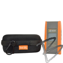
Flex Mini is a mapping grade GNSS that provides reliable and high-performance GPS reception to any computing device, such as a tablet or a smartphone. It can be used with various GIS and mapping apps to collect and process spatial data in the field. Flex Mini offers different levels of accuracy, depending on the receiver type, the correction method, and the environmental conditions.
With Flex Mini, reliable and accurate data collection is the value proposition for the GIS community. For example, Flex Mini can be used to locate features that are too numerous or too dynamic to be mapped by traditional methods, such as utility poles, fire hydrants, or stormwater drains. Flex Mini can also be used to collect new data for GIS applications, such as the location of new features or the condition of existing features.