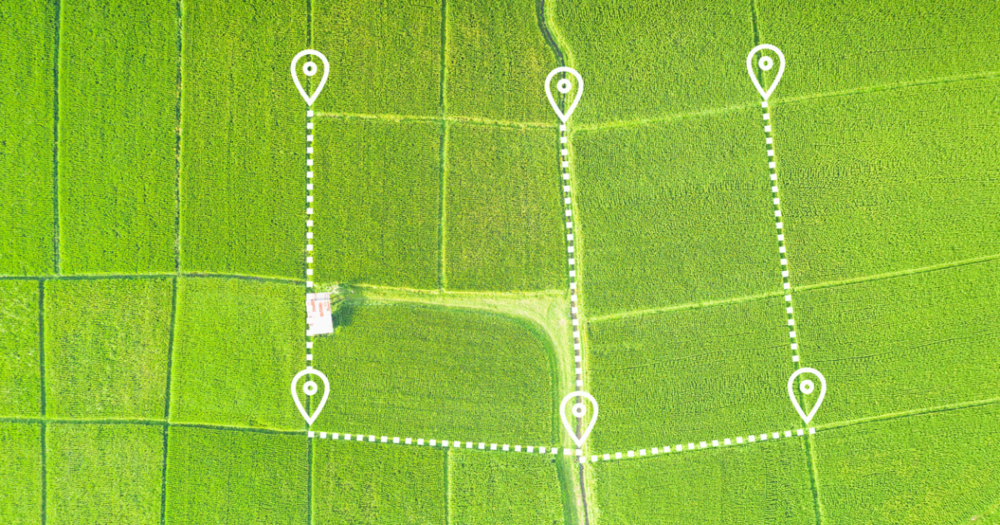
Real-time kinematic surveying represents a significant advancement in precision field mapping technology. It leverages the Global Navigation Satellite Systems to achieve unparalleled accuracy. This capability is crucial across various applications where precise measurements are paramount.
Let’s delve deeper into how RTK works and its components to explore its transformative impact on industries reliant on exacting land surveys.
Real-time kinematic (RTK) surveying is a technique that provides high-precision satellite data by correcting signals from the Global Navigation Satellite Systems (GNSS).
The GNSS is a constellation of satellites providing signals from space that transmit positioning and timing data to GNSS receivers. These systems include the well-known GPS (Global Positioning System) of the United States and other satellite navigation systems like Russia's GLONASS, Europe's Galileo, and China's BeiDou.
The GNSS receivers use this data to determine precise locations on Earth's surface. However, various errors, such as atmospheric interference, can affect GNSS signals, leading to less accurate positions.
RTK technology plays a critical role in enhancing the accuracy of GNSS data. It uses a fixed base station that broadcasts corrections to a mobile receiver or rover to reduce the errors associated with GNSS signals.
The base station is positioned at a known location, and it continuously monitors the GNSS signals to identify any discrepancies between the predicted and actual measurements. These corrections are then transmitted in real-time to the rover, allowing it to calculate its position with centimeter-level precision.
This method is invaluable for applications requiring high levels of accuracy, such as land surveying, construction, and agriculture.
An RTK system comprises three main components, each playing a role in achieving high-precision positioning:

RTK surveying offers advantages that significantly enhance surveying practices across various industries. By leveraging this advanced technology, professionals can achieve unparalleled results.
Here are the key benefits of employing RTK surveying in your projects:
One of the most compelling benefits of RTK surveying is its exceptional precision and accuracy.
Correcting GNSS signal errors in real-time, RTK systems enable users to pinpoint locations with centimeter-level accuracy. This degree of precision is critical for applications where even minor discrepancies can lead to significant issues or increased costs.
RTK typically achieves precision within 1-2 centimeters. This level of accuracy is possible due to the real-time corrections transmitted from the base station to the mobile receiver, which compensates for any potential GPS signal errors almost instantaneously.
RTK surveying provides the advantage of real-time data processing, allowing surveyors to receive immediate feedback on location accuracy as they work.
This capability speeds up the surveying process and enables dynamic adjustments on-site, enhancing operational efficiency and productivity. Immediate data processing ensures potential issues are identified and corrected on the fly to minimize delays and rework.
With RTK surveying, the need for extensive data post-processing is significantly reduced (if not entirely eliminated).
The real-time corrections offered by RTK systems streamline the surveying workflow. This leads to considerable savings in time and labor costs. Projects that once took days to complete can now be accomplished in a matter of hours, freeing up resources for other tasks and reducing overall project timelines.
The consistency RTK surveying technology provides ensures that measurements are reliable and repeatable. This repeatability is crucial for long-term projects or those requiring multiple surveys over time, such as infrastructure monitoring or environmental research.
If you want to enhance the accuracy of your field measurements with high-precision RTK technology, Baseline Equipment offers RTK systems that help streamline your surveying tasks.
While RTK surveying offers numerous benefits, here are several key challenges and considerations in RTK surveying:
One of the primary challenges in using RTK surveying is maintaining a clear line of sight between the GNSS satellites, the base station, and the rover.
Physical obstructions such as buildings, trees, or terrain features can interfere with signal reception, leading to decreased accuracy or data loss. Planning surveying activities to minimize these obstructions and strategically positioning equipment can help mitigate these issues but require forethought and expertise.
RTK systems often rely on cellular or radio networks to communicate correction data between the base station and the rover.
Consequently, the availability and reliability of these networks become crucial factors in RTK surveying operations. In remote or rural areas where network coverage is limited or nonexistent, maintaining a consistent communication link can be challenging and potentially impact the effectiveness of surveying activities.
Setting up an RTK system involves precise calibration and configuration to ensure accurate measurements. This process can be complex and requires understanding the equipment and the specific surveying environment.
Misconfiguration or errors during setup can lead to inaccurate data, underscoring the importance of thorough training and experience in RTK system operation.
Investing in RTK surveying technology entails significant upfront costs for equipment and software and ongoing maintenance, updates, and network services expenses.
For many organizations, particularly small firms or those new to advanced surveying techniques, these costs can be a considerable barrier to adoption. Evaluating the long-term benefits and potential ROI (return on investment) is crucial when considering implementing RTK surveying solutions.
Addressing these challenges head-on ensures you can fully leverage the high accuracy and efficiency of RTK surveying while minimizing drawbacks and optimizing overall survey performance.

RTK technology applications are vast and varied, reflecting its ability to enhance efficiency and accuracy across numerous fields.
Below are some key areas where RTK surveying is making a significant impact.
RTK surveying is indispensable in land development and construction.
It enables precise mapping and layout of future construction sites, ensuring that every measurement is accurate to the centimeter. This precision is crucial for site planning, design, and legal documentation by reducing the risk of costly errors.
Furthermore, RTK systems facilitate the real-time monitoring of structures for potential shifts or settling to enhance safety and regulatory compliance.
Agriculture has also benefited significantly from RTK technology.
By enabling farmers to map their fields with exacting detail, RTK surveying efficiently allocates resources such as water, fertilizers, and pesticides. This maximizes yield and minimizes environmental impact.
Additionally, RTK-guided machinery can plant and harvest crops with unprecedented precision to reduce waste and improve productivity.
Infrastructure health – from bridges and roads to utilities and buildings – is critical for public safety and economic activity.
RTK surveying aids in regularly monitoring and maintaining these assets by providing precise measurements that can detect even minor shifts or deterioration over time from climate change or other factors. Early detection is critical to preventing failures and planning maintenance work with minimal disruption.
Finally, RTK surveying is a powerful tool in mapping and environmental research. It supports the creation of detailed topographical maps, aiding in studying and managing natural resources and hazards.
Environmental scientists use RTK data to monitor changes in landscapes caused by factors like erosion, deforestation, or climate change, contributing valuable insights into sustainable practices and policy-making.
The primary difference between traditional kinematic surveying and RTK surveying lies in the timing and accuracy of the data processing.
RTK and RTCM (Radio Technical Commission for Maritime Services) serve different purposes in satellite navigation systems.
In essence, while RTK is a method or technique for achieving high precision in GPS positioning, RTCM is a standard that supports this method by enabling the efficient transmission of correction data necessary for precision.
Single-base RTK involves one base station providing corrections to the rover. This setup limits the operating range to ensure accuracy, as the distance between the base station and the rover can affect error correction.
Network-based RTK uses multiple base stations that feed data into a network, creating a model of error corrections. This approach allows for greater coverage and high accuracy over larger geographic areas to reduce distance-related limitations from a single base station. This makes network RTK more flexible and scalable for extensive survey operations.
Despite its challenges, the advantages of RTK technology far outweigh the obstacles. Embracing RTK surveying equips professionals with the tools to execute their projects with unprecedented precision and efficiency, ensuring that every measurement counts.