What Is the Difference Between GPS and DGPS?

A gps satellite orbiting the earth.


In today's digital age, the Global Positioning System (GPS) and its refined counterpart, Differential GPS (DGPS), are at the forefront of technological advancements that drive precision in various critical fields. So whether you’re a professional surveyor, a construction manager, or someone interested in the technological intricacies of location services, understanding the capabilities and differences between GPS and DGPS is essential for leveraging their full potential.

Understanding GPS

At its core, GPS is a satellite-based navigation system that provides users with precise location data, which is pivotal for tasks ranging from mapping and land surveying to guiding equipment and ensuring safety on construction sites.

How GPS Functions

GPS comprises three main segments:

  • Space Segment: This consists of the constellation of satellites that transmit signals to users on Earth.
  • Control Station Segment: Ground-based stations monitor the satellites, track their precise orbits, and manage their functionality.
  • User Segment: This segment comprises the GPS receivers used by individuals and various industries to determine their exact location based on the signals from the satellites.

GPS operates through a network of satellites orbiting the Earth, maintained by the United States government. These satellites transmit signals that can be received by GPS receivers anywhere on the planet, provided there is an unobstructed line of sight.

A GPS receiver calculates its position by precisely timing the signals multiple satellites send. Each satellite transmits data that includes the time the message was transmitted and the satellite's position at that time.

By determining the distance away from at least four satellites, the receiver can calculate its location on Earth in three dimensions: latitude, longitude, and altitude.

Limitations of GPS

Despite its widespread application and utility, GPS has limitations. These limitations can affect the accuracy and reliability of GPS data.

Signal blockage

Urban environments, dense forests, or any setting with large obstructions can block the direct signal path between satellites and the GPS receiver. This blockage can lead to inaccuracies in the calculated position.

Multipath interference

This occurs when GPS signals reflect off surfaces such as buildings or large rock faces before reaching the receiver. The delayed arrival of these signals can cause errors in positioning.

Accuracy levels under standard conditions

Under ideal conditions, GPS accuracy can vary. Generally, commercial GPS receivers are accurate to within 5 to 10 meters. However, this level of accuracy might not suffice for many professional tasks like surveying and construction, necessitating more precise systems like DGPS.
Introduction to DGPS

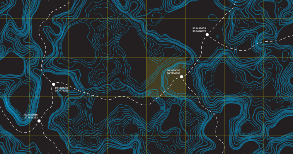
A vector topographical map created using DGPS.

DGPS represents a significant advancement in precision navigation and positioning technologies.

Designed to enhance the accuracy of standard GPS readings, DGPS is a critical tool for professionals in surveying, construction, and safety sectors where precise location data is not just beneficial but often required.

DGPS Purpose and Function

Like GPS, DGPS systems involve the same three segments with one critical difference: the integration of base stations.

DGPS enhances conventional GPS systems by utilizing ground-based reference stations and the satellites used by standard GPS.

The primary purpose of DGPS is to improve the accuracy of location data. While standard GPS can provide location accuracies of about 5 to 10 meters under optimal conditions, DGPS tightens this accuracy to within 1 to 3 meters and, in some cases, even better.

Base stations receive GPS signals and compare the positions these signals indicate against their known actual positions. The difference between the received and known true positions is the error. Base stations then broadcast these error corrections to users within a specific geographic area.

How DGPS Works

DGPS enhances the accuracy of location data beyond what is achievable with standard GPS through the correction process. This process involves real-time and post-processing methods to refine the positional information received by GPS receivers.

The correction process in DGPS uses two primary methodologies: real-time corrections and post-processing.

Real-Time Corrections

  • In real-time DGPS, correction data is transmitted from base stations to mobile receivers almost instantaneously.
  • The base station calculates errors by comparing the expected positions (based on its known location) with the positions indicated by the GPS signals. It broadcasts these error corrections to receivers in the area.
  • The receivers then apply these corrections to their GPS data in real time, allowing immediate use of the enhanced data.
  • This method is beneficial for applications that require high precision in real-time, such as navigation and certain types of surveying.

Post-Processing

The DGPS corrections can be applied after the data collection for applications where real-time data is not critical.

  • The raw GPS data collected by the receivers is later corrected using data logged by the reference station during the same time period.
  • Post-processing can sometimes achieve even higher levels of accuracy than real-time corrections, as it allows for more thorough analysis and correction of the data.

Can standard GPS units use DGPS signals?

To utilize DGPS, a GPS unit must be compatible with or capable of receiving DGPS signals. Not all standard GPS units have this capability, so whether you can use DGPS might depend on the specific model and its features.

  • DGPS-compatible receivers: Some GPS receivers are designed to be compatible with DGPS. These units have the necessary hardware to receive correction signals from DGPS reference stations or via satellite-based augmentation systems.
  • Standard GPS units: Regular GPS units without built-in DGPS functionality cannot directly use DGPS corrections unless connected to an external source that provides DGPS data. This could be a separate DGPS receiver or a module that collects and feeds DGPS corrections into the standard GPS unit.
  • Upgrading capability: In some cases, upgrading a standard GPS unit to become DGPS-capable through additional hardware or software enhancements that enable it to receive and process DGPS signals is possible.

When purchasing a GPS unit, it's important to check the specifications to determine if the device supports DGPS or can be configured for DGPS. This will ensure you get the accuracy required for your specific needs.

If you’re considering upgrading your current GPS system to take advantage of DGPS technology, Baseline Equipment provides solutions that make this transition smooth and efficient.

Comparing GPS and DGPS

A man using gps to survey his farm land.

When evaluating the capabilities of GPS and DGPS, the distinction in accuracy levels they provide stands out as a critical factor.

Accuracy Differences

Standard GPS systems, while revolutionary in providing global positioning capabilities, typically offer accuracy within 5 to 10 meters under optimal conditions. This level of precision suffices for general navigation and some broad-scale applications.

DGPS, on the other hand, significantly enhances accuracy. By correcting signal errors through reference stations, DGPS can achieve accuracy levels within 1 to 3 meters and often even better (depending on the specific setup and conditions).

  • Surveying: In surveying, the difference of a few meters can drastically affect project outcomes. DGPS allows surveyors to map and measure land more precisely, ensuring that boundaries are accurately determined and infrastructure projects are based on reliable data.
  • Precision Agriculture: For agriculture, DGPS enables practices such as variable rate technology (VRT), where inputs like fertilizers, herbicides, and seeds are applied at variable rates across a field to optimize growth and yield. Precision agriculture practices require accurate positioning to allocate resources efficiently and minimize environmental impacts.
  • Mapping: Mapping landscapes, whether for environmental monitoring, urban planning, or emergency management, demands high accuracy to be effective. DGPS provides the level of detail necessary for creating accurate and useful maps, helping to inform decision-making and resource allocation.

Technological Differences

At their technological core, standard GPS and DGPS systems utilize similar satellite signals for positioning. However, their equipment and methods for processing these signals diverge significantly.

Standard GPS receivers collect signals from satellites to determine a position based on the timing and positioning of these signals.

  • The hardware required for GPS is relatively straightforward, consisting of the receiver and an antenna.
  • These devices are designed to be highly portable and user-friendly, with minimal setup required to start collecting location data.

DGPS systems add a layer of complexity to the basic GPS setup.

  • In addition to the roving receiver used by standard GPS, DGPS requires a network of ground-based reference stations equipped with receivers and antennas. This requires additional communication equipment or access to a service that broadcasts these corrections.

Operational Differences

The introduction of reference stations and the need for correction signal transmission in DGPS systems lead to notable operational differences compared to standard GPS setups.

Standard GPS systems are relatively plug-and-play.

  • They do not require the user to manage infrastructure beyond the handheld or vehicle-mounted receiver.
  • This simplicity extends to the system's maintenance, which typically involves standard hardware upkeep without the need to manage a network of reference stations or correction data subscriptions.

DGPS systems involve setting up reference stations at known coordinates, which must be precisely surveyed.

  • This setup is inherently more complex and costly than deploying standard GPS receivers.
  • Furthermore, the maintenance of these stations and the necessity to ensure uninterrupted transmission of correction data adds to DGPS's operational demands.
  • Users must either maintain their own network of reference stations or subscribe to a correction service provider (which can include ongoing costs).

These distinctions underscore the trade-off between DGPS's enhanced accuracy and standard GPS's simplicity and lower cost.

Application Differences

GPS technology has become integral to everyday life and various industries, offering location services that are accurate enough for a broad range of activities:

  • Navigation: GPS is the backbone of modern navigation systems used in vehicles, smartphones, and portable devices.
  • Recreational use: Outdoor enthusiasts use GPS for hiking, geocaching, and marine navigation.
  • Basic field data collection: Professionals in environmental science, agriculture, and urban planning use GPS to collect field data when high precision is not critical.

DGPS shines in scenarios where the limitations of GPS's accuracy could compromise the outcome of professional tasks:

  • Surveying and construction: In surveying land or setting out construction sites, the enhanced accuracy of DGPS is crucial for ensuring that measurements are precise.
  • Precision agriculture: DGPS enables farmers to implement precision farming techniques, such as mapping fields for planting, fertilizing, and harvesting, optimizing resource use, and increasing yields.
  • Scientific research: Researchers conducting environmental monitoring or geological studies rely on the precision of DGPS to gather accurate spatial data, essential for analyzing changes over time or mapping terrain.

Scenarios Where DGPS Provides Significant Advantages

In certain environments and specialized applications, the advantages of DGPS over GPS are particularly pronounced:

  • Dense urban environments: The "urban canyon" effect in cities, where tall buildings can reflect or block GPS signals, often reduces standard GPS accuracy. With its ability to correct signal errors, DGPS can provide more reliable positioning for navigating these challenging environments.
  • Detailed scientific research: Many scientific research projects require highly accurate spatial data. For example, studying the movement of tectonic plates or monitoring coastal erosion necessitates the precision that DGPS offers.
  • Maritime navigation: DGPS's improved accuracy and reliability over GPS in marine environments can significantly enhance safety and efficiency. This is especially true for navigating narrow channels or entering and exiting ports.

While GPS provides a universally accessible solution for location-based services, DGPS extends the boundaries of what's possible with satellite navigation, delivering the precision needed for professional, safety-critical, and scientific applications.

Understanding the Value of GPS and Power of DGPS

The distinction between GPS and DGPS lies in their technological mechanisms and applicational impact, highlighting the evolution of technology in meeting the demands of modern precision.

Explore the differences between GPS and DGPS, detailing their applications in surveying, navigation, and precision-required tasks, to understand which system best suits your professional needs.