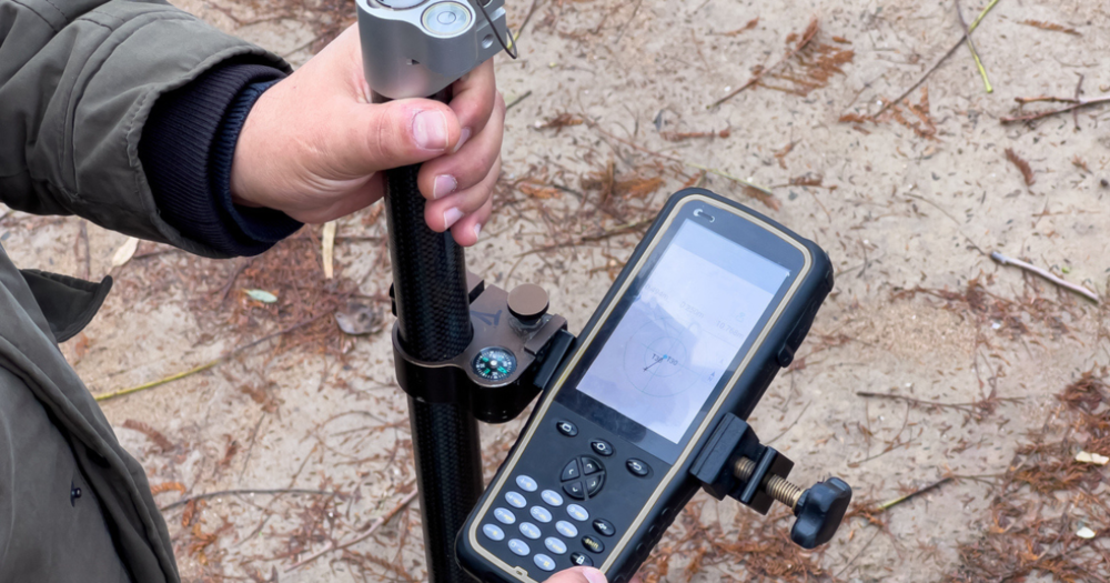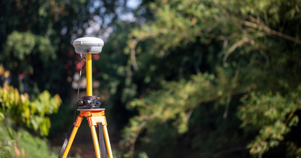
The complexity of surveying tasks can vary significantly. Surveying professionals need different GPS models depending on whether they conduct basic, intermediate, or advanced tasks.
Letís break down these levels to understand what each entails and the type of equipment best suited for each.
Different Surveying Tasks
Understanding the different levels of surveying tasks can help you choose the appropriate GPS models for your projects.
Basic Surveying Tasks
Basic surveying tasks are typically straightforward and require less sophisticated equipment. These tasks include boundary marking, property surveys, and simple topographical surveys.
- Boundary marking involves identifying the precise points that define property lines. Landowners and real estate developers must provide accurate boundaries.
- Property surveys are conducted to determine a specific parcel of land's boundaries, features, and topography. They are often required during property transactions.
- Simple topographical surveys map the contours and features of a land area, providing essential data for planning and development.
GPS models like
handheld receivers or entry-level GNSS systems are highly effective for these tasks. They provide sufficient accuracy for basic needs and are user-friendly, even for those new to surveying.
Intermediate Surveying Tasks
Intermediate surveying tasks require more detailed and precise measurements. They are critical in construction and infrastructure projects, where accuracy and reliability are paramount.
- Construction layouts involve determining the exact locations of buildings, roads, and other infrastructure based on the construction plans. Precision is crucial to avoid costly mistakes.
- Infrastructure planning involves surveyors creating detailed plans for utilities, transportation networks, and other infrastructure projects. Accurate data provides efficient and safe designs.
- More detailed topographical surveys provide a comprehensive view of the landís surface, capturing smaller details and variations in elevation.
Mid-range GNSS systems with higher accuracy and more features, such as
real-time kinematic (RTK) GPS units, are recommended for intermediate tasks. These models are designed to handle the increased demands of this surveying level.
Advanced Surveying Tasks
Advanced surveying tasks are the most complex and demand the highest precision and sophistication. These tasks are typically undertaken for large-scale projects and scientific research.
- Geodetic surveys measure large portions of the Earthís surface, accounting for its curvature. They are used for creating maps, defining property boundaries over large areas, and various scientific applications.
- High-precision engineering projects require highly accurate measurements to construct bridges, tunnels, and skyscrapers. Any error can lead to significant safety risks and financial costs.
- Large-scale mapping requires advanced GPS technology for data accuracy and coverage.
For such demanding tasks, high-end GNSS systems that offer sub-centimeter accuracy and advanced features are necessary. These top-tier models are equipped with state-of-the-art technology to meet the rigorous requirements of advanced surveying.
To understand what to consider when choosing different GPS survey models, read:
GPS Surveying Equipment for Basic Tasks

Entry-level GPS models offer an affordable and user-friendly solution for basic surveying tasks such as property boundary surveys and simple land measurements. These models provide sufficient accuracy for straightforward surveying needs without the complexity and cost associated with more advanced equipment.
Bad Elf Flex Mini Standard GPS Receiver
The
Bad Elf Flex Mini Standard GPS Receiver is compact and affordable, providing reliable performance for basic surveying tasks.
- With its straightforward setup and operation, users can quickly get started on their surveying projects.
- It also has excellent battery life, so it can last a full day of work without needing frequent recharges.
- Its compatibility with various data collection apps and software increases its versatility, allowing seamless integration into existing workflows.
Bad Elf Flex Mini Extreme GPS Receiver
The
Bad Elf Flex Mini Extreme GPS Receiver offers additional features and precision, making it suitable for more detailed entry-level projects.
- With boosted accuracy and advanced capabilities, this receiver is ideal for users needing more precision without stepping into mid-range equipment.
- It features improved satellite tracking, real-time data correction, and increased connectivity options for reliable performance in challenging environments.
- The Flex Mini Extreme boasts long battery life, a rugged design, and compatibility with various data collection and mapping applications.
Garmin eTrex Series
The
Garmin eTrex series is known for its affordability and ease of use.
- These handheld GPS units offer reliable performance with sufficient accuracy for basic surveying tasks.
- They feature durable designs suitable for various outdoor conditions and include functionalities like waypoint marking, route plotting, and basic mapping, making them ideal for property boundary surveys and simple land measurements.
Magellan eXplorist Series
The
Magellan eXplorist series provides good performance at an affordable price.
- It features intuitive navigation and long battery life.
- These units are designed to withstand tough conditions and provide essential features needed for basic surveying tasks.
Check out the various GPS models Baseline Equipment has to offer.
GPS Surveying Equipment for Intermediate Tasks

Intermediate surveying tasks such as construction layout, infrastructure planning, and moderate topographical surveys require GPS models that offer higher accuracy, durability, and advanced software integration.
Mid-range models balance sophisticated features and cost-effectiveness, making them ideal for these more demanding projects.
Bad Elf Flex GPS Receiver Standard
The
Bad Elf Flex GPS Receiver Standard is versatile and cost-effective for various surveying tasks.
- Unlike the Mini version, the Standard model offers increased durability and improved satellite tracking, making it suitable for both basic and intermediate surveying needs.
- Its broader compatibility with various data collection apps and software boosts its versatility, allowing seamless integration into more complex workflows.
- It includes advanced connectivity options for better data transfer and real-time corrections, providing a reliable and efficient solution for surveyors requiring more capability without the complexity of high-end models.
Bad Elf Flex Extreme GPS Receiver
The
Bad Elf Flex Extreme GPS Receiver offers additional features and precision, making it suitable for more detailed projects.
- The Extreme provides significantly improved accuracy and advanced capabilities compared to the Mini model.
- This receiver features improved satellite tracking, real-time data correction, and connectivity options for reliable performance in challenging environments.
- The Flex Extreme boasts long battery life, a rugged design, and compatibility with various data collection and mapping applications.
Trimble R2 GNSS Receiver
The
Trimble R2 GNSS Receiver offers high accuracy and advanced capabilities for surveying tasks.
- This receiver is designed for versatility, providing reliable performance in various conditions. Its compact and durable design makes it easy to use in the field.
- The Trimble R2 supports multiple GNSS constellations, offering better satellite tracking and real-time data correction.
- Its long battery life and compatibility with a wide range of data collection software make it an excellent choice for basic and advanced surveying projects.
Leica GS07 GNSS System
The
Leica GS07 GNSS System is a high-performance receiver for precise and reliable surveying tasks.
- With its advanced GNSS technology, the GS07 provides exceptional accuracy and real-time data correction.
- The system is user-friendly, with a straightforward setup and operation housed in a rugged design.
- The Leica GS07 also features long battery life and seamless integration with multiple data collection and mapping applications, making it ideal for detailed and complex surveying projects.
Explore all of our GPS and RTK models for land surveying.
GPS Surveying Equipment for Advanced Tasks

Advanced surveying tasks demand GPS models with the highest accuracy and advanced features. High-end models are equipped with state-of-the-art technology to meet these rigorous requirements.
Stonex S900 GNSS Receiver and Receiver Bundle
The
Stonex S900 GNSS Receiver and Receiver Bundle is a comprehensive solution for professional surveying tasks.
- This receiver offers superior accuracy and advanced GNSS technology, making it suitable for various surveying applications. The bundle includes everything needed for efficient fieldwork, increasing productivity, and ease of use.
- Its durable design creates a reliable performance in various environmental conditions, while its compatibility with multiple data collection software solutions allows for seamless workflow integration.
- The Stonex S900 also features advanced connectivity options, real-time data correction, and long battery life, making it a dependable choice for intermediate and advanced surveying projects.
Stonex SR35 U UHF Radiomodem
The
Stonex SR35 U UHF Radiomodem provides reliable communication and data transfer for surveying equipment.
- This model provides stable and long-range data transmission, essential for precise and efficient field operations.
- Its robust construction and advanced technology allow it to perform well in various environmental conditions, providing dependable performance for surveyors.
- The SR35 U supports multiple communication protocols, making it compatible with a wide range of GNSS receivers and other surveying equipment.
- Its ease of use and reliable performance make it an essential accessory for strengthening the functionality of GNSS systems in challenging environments.
Stonex Cube-a GPS Software
The
Stonex Cube-a GPS Software is a powerful tool designed to better the capabilities of GNSS receivers.
- This software offers advanced data collection, processing, and analysis features, making it suitable for various surveying tasks. Its user-friendly interface guarantees ease of use, even for complex projects.
- Cube-a is compatible with a wide range of GNSS receivers, providing flexibility and versatility in data management.
- The software includes real-time data correction, advanced mapping capabilities, and comprehensive reporting tools, making it essential for modern surveying workflows.
Trimble R12 GNSS System
The
Trimble R12 GNSS System offers exceptional accuracy and advanced features for professional surveying tasks.
- This receiver is equipped with Trimble's latest GNSS technology for precise and reliable performance in various conditions. Its robust design makes it suitable for demanding field environments.
- The Trimble R12 supports multiple GNSS constellations, providing increased satellite tracking and real-time data correction for superior accuracy.
- Its long battery life and extensive compatibility with data collection software make it an excellent choice for basic and advanced surveying projects.
- The system also features advanced connectivity options, providing efficient data transfer and integration into existing workflows.
Leica GS18 T GNSS RTK Rover
The
Leica GS18 T GNSS RTK Rover is a high-precision receiver designed for complex, detailed surveying tasks.
- This rover utilizes advanced GNSS and RTK technology to deliver exceptional accuracy and real-time data correction. Its user-friendly design allows for quick and efficient setup and operation.
- The GS18 T is built to withstand harsh field conditions, featuring a rugged construction built for durability and reliability.
- With long battery life and compatibility with a wide range of data collection and mapping applications, the Leica GS18 T is ideal for professional surveyors who require precise and dependable performance.
- The rover's advanced features, including tilt compensation and boosted connectivity options, make it a top choice for detailed and challenging surveying projects.
See all of the GPS models we currently carry.
Optimize Your Surveying
Whether you're conducting property boundary surveys, construction layouts, or geodetic surveys, there are GPS models tailored to meet the specific needs of your projects.
Explore the recommended models and equip yourself with the best tools to tackle any surveying challenge confidently.
Choose the right GPS model for your surveying needs. Discover GPS models for basic to advanced tasks and optimize your surveying efficiency. Learn more now!