Choosing the right surveying equipment is crucial for the success of any construction,
land surveying, or environmental study project. As technology evolves, the capabilities and complexities of surveying tools like handheld GPS units and total stations have significantly advanced, offering varied applications and benefits.
Whether navigating the canopy of a forest or requiring meticulous detail on a construction project, understanding the strengths and limitations of handheld GPS units and total stations will help you make the right choice for your project.
Understanding Handheld GPS Units
Among the plethora of tools available, handheld GPS units stand out for their unique capabilities and applications.
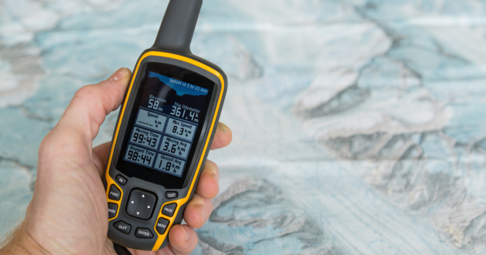
Handheld GPS (Global Positioning System) units are compact, portable devices that provide geographical positioning information anywhere on Earth. These units leverage signals from satellites to pinpoint exact locations.
Unlike traditional surveying instruments, handheld GPS units offer the advantage of mobility, enabling users to carry them across different terrains and locations easily.
Key Features
The core technology behind handheld GPS units is their ability to communicate with a network of satellites to determine precise location coordinates. Some features include:
- High-sensitivity GPS receivers: These receivers enhance the ability to pick up satellite signals under dense foliage or in urban settings with tall buildings.
- Multi-GNSS (Global Navigation Satellite System) support: Modern units support American GPS and other global systems, ensuring more accurate positioning through satellites.
- Robust design and connectivity: Designed for field work, these units often have rugged, weather-resistant exteriors and options for wireless connectivity to share data in real time.
Accuracy Levels
The accuracy of handheld GPS units can vary depending on the device and conditions.
- Standard consumer-grade units typically offer accuracy within 5 to 10 meters.
- Under optimal conditions, professional-grade models equipped with differential GPS (DGPS) technology can achieve accuracy down to less than a meter under optimal conditions.
Satellite Dependency
Handheld GPS units rely entirely on satellite signals. This dependency means that atmospheric conditions, satellite geometry, and obstructions like buildings or heavy tree cover can affect their accuracy and functionality.
Despite these potential issues, advancements in GPS technology and multi-GNSS support have mitigated most of these limitations.
Common Applications
Handheld GPS units are ideally suited for a wide range of applications, including:
- Land surveying:For preliminary assessments and mapping large areas where high precision is not the primary concern.
- Environmental studies: To map and monitor environmental changes over large areas.
- Agriculture: For mapping fields, planning land use, and precision farming practices.
- Outdoor adventures: Used by hikers, mountain bikers, and outdoor enthusiasts to navigate and track their routes.
Check out handheld GPS units at Baseline Equipment.
Understanding Total Stations

Total stations represent a cornerstone technology in modern surveying and construction, offering an unparalleled blend of accuracy, efficiency, and versatility.
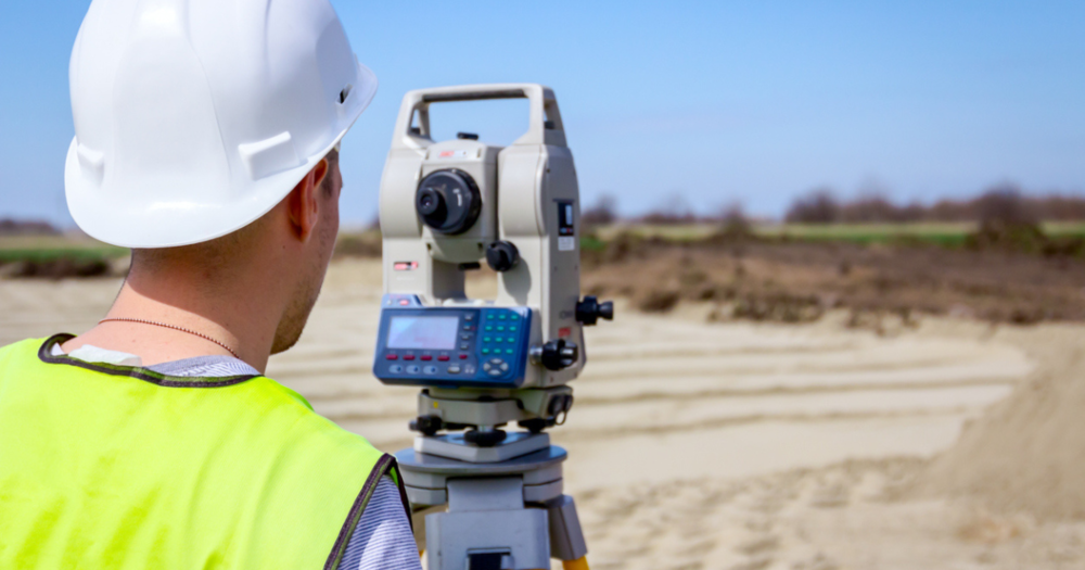
A total station is an electronic/optical instrument used for surveying and building construction. It combines the functionalities of an electronic theodolite with an electronic distance meter (EDM) to measure angles and distances.
This integration allows for the calculation of precise coordinates, which are essential for detailed mapping, planning, and construction projects. Total stations are distinguished by their ability to offer high degrees of precision in measurements, making them indispensable in fields that demand meticulous accuracy.
Key Features
Total stations are equipped with a range of features and technologies designed to enhance accuracy and ease of use:
- Angle measurement: Utilizing highly sensitive sensors and algorithms to measure horizontal and vertical angles with extreme precision.
- Distance measurement: The EDM component allows for rapid and accurate distance measurements by emitting laser pulses and calculating the time the reflection returns.
- Data processing and storage: Modern total stations can process and store measurement data on board, facilitating immediate analysis and reducing human error.
- Robotic operation: Some total stations are robotic (meaning they can be operated remotely), increasing efficiency by allowing a single operator to control the station and record data.
Accuracy Levels
The hallmark of total stations is their accuracy and precision.
- Depending on the model and conditions, these instruments can achieve angle measurement accuracies of up to 0.5 arc-seconds and distance accuracies of 1mm + 1ppm (parts per million).
This level of precision is critical for applications where even minor discrepancies can lead to significant issues or increased costs.
Integration with Other Surveying Technologies
Total stations are often used in conjunction with other surveying technologies to enhance capabilities and accuracy:
- EDM: Integral to total stations, allowing for high-precision measurement of distances up to several kilometers.
- GNSS receivers: For capturing broader geographical positioning data which can be refined with total station measurements for comprehensive survey results.
- GIS (Geographic Information Systems): Total stations contribute detailed local data to GIS, enriching these systems with high-precision measurements for analysis and decision-making.
Common Applications
Total stations are suited to a wide array of applications requiring precise measurements, including:
- Land surveying: Essential for boundary surveys, topographic surveys, and subdivision planning, where exact measurement is crucial for legal and construction purposes.
- Construction:For layout, verification, and as-built surveys.
- Civil engineering: In designing and monitoring infrastructure projects like roads, bridges, and utilities.
- Archaeology: For detailed recording of excavation sites.
- Forensic investigation: To accurately document crime scenes or accident sites.
Discover total station solutions at Baseline Equipment.
Comparing Handheld GPS Units and Total Stations

Each technology offers unique benefits and limitations, making them suitable for different tasks and environments.
Level of Precision
- Total stations are renowned for their high precision. They offer angle measurement accuracy up to 0.5 arc-seconds and distance accuracy of 1mm + 1ppm.
- Handheld GPS units typically provide accuracies within 5 to 10 meters for consumer-grade models and less than a meter for professional-grade units with differential GPS.
Data Collection Capabilities
- Total stations capture highly accurate positional data for points within their line of sight, making them ideal for detailed, localized surveys.
- Handheld GPS units are better suited for collecting geospatial data over larger areas where pinpoint accuracy for each point is less critical.
Ease of Setup
- Total stations require a more meticulous setup to ensure accuracy (including calibration and alignment), making them more time-intensive to start working with.
- Handheld GPS units boast ease of use and minimal setup time, allowing for quick deployment across various locations.
Use Flexibility
- Total stations are ideal for static projects where the setup can remain unchanged for extended periods, ensuring high precision in measurements.
- Handheld GPS units are highly beneficial in dynamic environments where surveyors must move frequently or cover large, uneven areas.
Environmental Factors
- Total stations are best in environments where a clear line of sight can be maintained, such as open construction sites or lightly wooded areas.
- Handheld GPS units perform well in scenarios where such conditions cannot be guaranteed, including densely forested regions or urban settings with tall buildings.
Logistical Considerations
- Total stations, with their higher cost and need for skilled operation, are more suited to projects where accuracy and detail outweigh budgetary and time constraints.
- GPS units are more user-friendly and quicker to deploy, so they might suit short-term, extensive, or preliminary projects with limited budgets.
Technological Advancements
- Total Stations are continually improving with enhancements in optical and laser technologies, increasing measurement accuracy and speed.
- Handheld GPS Units, with advances in satellite technology and signal processing, improve accuracy and reliability, even under challenging conditions.
- Increased compatibility with multiple global navigation satellite systems (GNSS) ensures broader and more accurate coverage.
Making the Right Choice in Surveying Technology
Both
handheld GPS units and total stations offer distinct advantages that make them invaluable tools in surveying. The choice between these two types of equipment should be guided by your project's specific requirements, the environmental conditions you will face, and the level of precision necessary to meet your objectives.
Choose the best surveying tool for your project by comparing handheld GPS units and total stations, covering precision, ease of use, and suitability for various environments.

