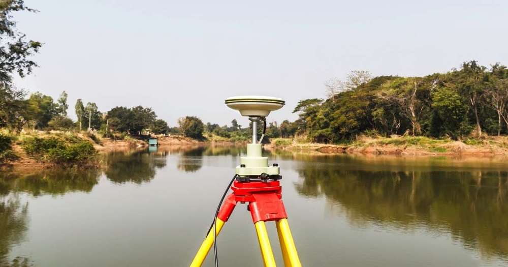
Land surveying is all about accuracy and modern technology makes all the difference. Over the years, advances in technology have revolutionized the surveying industry. Global positioning system (GPS) software, integrated lasers, and ultrasonic technology make it possible to complete jobs faster than ever and with greater accuracy.
One of the biggest developments that continues to advance the surveying industry today, especially in light of the COVID-19 crisis, is the robotic total station. Here is what you need to know about working remotely using a robotic total station.
Also known as a total station theodolite (TST), a total station is an electronic surveying instrument used in construction to measure both vertical and horizontal angles as well as slope distance. This kind of instrument collects data in an on-board computer and performs triangulation calculations with expert precision.
A robotic total station (RTS) is just what it sounds like - an instrument that can be operated remotely. This eliminates the need for a second operator and drastically increases the number of calculations a team can perform in the field in less time than with a traditional total station.
The RTS was first introduced by Geodimeter in 1990, equipped with servomotors that automatically rotate the instrument and an Advanced Tracking Sensor (ATS) for tracking the prism. A wireless communication link between the prism pole and the RTS enables a single operator to control the device and carry out a survey.
The uses of total station technology are myriad and while there are some challenges making the transition, the benefits greatly outweigh the disadvantages. When it comes to the initial investment, robotic total station prices can be high but the cost savings on labor, travel time, and other expenses add up quickly.
Here are the top three benefits of using RTS technology:
Without a total station, a surveying team can expect to measure an average of 200 points per day with two people measuring on-site. Total station surveying doubles the number of points but still requires a second operator. With an RTS, a single operator can measure up to 600 points per day. This technology also allows for unmanned deformation monitoring.
A total station consists of a theodolite with a built-in distance meter that gathers information about angles and distances to determine the position and height of certain points. The unit is typically mounted on a tripod where it collects information from various points on the site.
RTS instruments feature remote control units that enable the controller to operate the device from the prism. The remote controller is positioned on top of the prism pole and connects wirelessly to the total station using Bluetooth technology. The operator performs all necessary measurements without needing to move from one location to another.
These instruments use auto-pointing software to automatically locate the prism and the remote control unit emits a laser beam picked up by the total station. They also use auto-tracking to follow the direction of a moving prism, ensuring precision even when maneuvering around construction debris and large equipment.
The first few months of 2020 have been tumultuous for the construction industry. In an effort to slow the spread of the novel coronavirus, non-essential businesses were shut down in many states and remote work is encouraged when possible.
In the construction and surveying industry, data must be collected in the field and many tasks require human operators. As states start to reopen, limited construction work is allowed to resume but social distancing measures are still in place.
Surveying companies that have access to RTS technology can still complete a total station survey without compromising the health and safety of their crew. With a GPS total station, crews can check measurements remotely to move forward in planning without having to physically revisit the site, as long as the product is still set up. Proper surveying ensures minimal rework and a faster completion time on projects.
The future holds a great deal of uncertainty for the nation as a whole. Even as businesses continue to reopen, major industries will be required to make adjustments, including surveyors. Once back in the field, surveyors can boost productivity and efficiency with RTS technology.
Land surveying is all about accuracy and modern technology makes all the difference. Over the years, advances in technology have revolutionized the surveying industry. Global positioning system (GPS) software, integrated lasers, and ultrasonic technology make it possible to complete jobs faster than ever and with greater accuracy.
One of the biggest developments that continues to advance the surveying industry today, especially in light of the COVID-19 crisis, is the robotic total station. Here is what you need to know about working remotely using a robotic total station.