
Land surveying is a critical component of many industries, from construction and real estate to cartography and engineering. The precision and accuracy it demands are paramount, as the information generated forms the very foundation upon which our built environment stands. At the heart of this meticulous process is a remarkable device known as the total station.
A total station is an essential instrument used in surveying and building construction. It's an integrated device combining the functions of a theodolite with an electronic distance measurement (EDM) component to measure angles and distances, respectively. The addition of an onboard computer makes it a highly sophisticated device, capable of storing vast amounts of data and performing complex calculations.
The total station's name derives from its comprehensive functionality: it's a 'total' solution for capturing spatial data, making it one of the most versatile tools in a surveyor's arsenal.

A total station is composed of several key parts:
Total stations are a pivotal tool in modern land surveying and come in various forms, each designed to meet different needs and provide diverse functions. The major types of total stations can be broadly categorized as follows:
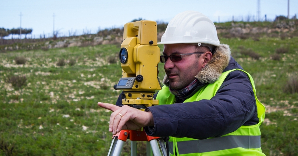
Manual total stations, as the name suggests, require manual intervention for their operation. The surveyor needs to physically aim the device at the target, usually a reflective prism, by peering through the telescope and adjusting the device accordingly. Once the target is sighted, the surveyor triggers the EDM to measure the distance.
These models are typically more affordable and offer the control that some surveyors prefer. However, they can be labor-intensive and time-consuming, especially for large surveys, as they require an operator at the instrument and another person holding the prism at the target point.
Robotic total stations bring a level of automation and efficiency to the surveying process. They're capable of automatically tracking a moving prism, allowing a single operator to manage both the total station and the prism. These devices can also be controlled remotely via a handheld device, often with the capacity to input data and commands directly into the total station from a distance.
While Robotic Total Stations tend to be more expensive than their manual counterparts, they offer significant benefits in terms of time savings and manpower reduction. They're particularly effective for large-scale projects that require extensive surveying.

A total station is more than a simple surveying tool�it's a versatile instrument that can perform a myriad of tasks. Here are some key functions:
The most common task performed by total stations is measuring distances. Whether it's a short distance for small construction layouts or long distances for large-scale topographic surveys, the total station can handle it with remarkable accuracy.
With their built-in theodolite function, total stations can precisely measure both horizontal and vertical angles. This capability is crucial for tasks like defining property boundaries or setting out building corners.
Determining the elevation or altitude of a point is another key task for total stations. This is especially important in construction, civil engineering, and flood risk assessments.
Total stations can store vast amounts of data for later reference or processing. This allows surveyors to take measurements in the field and then analyze the data in the office.
In construction projects, total stations can help translate designs from blueprints to the real world, marking exact locations for features like walls, foundations, and utilities.
Total stations are essential for creating detailed topographic maps, which show the contours and features of the land.
Operating a total station involves a series of steps that ensure accurate and efficient measurements. Here is a simplified guide:

Choosing the right total station for your needs is a critical decision. Here are some factors to consider:
Total stations have truly revolutionized the field of land surveying. From their ability to measure distances and angles with remarkable precision to their potential to integrate with other technologies and automate numerous tasks, these instruments have proven to be invaluable to surveyors across the globe.