Climate change is one of the most pressing global issues of our time, and its impact on land surveying is significant and multifaceted. As temperatures increase, weather patterns become more extreme. Land surveying professionals must adapt to new challenges and find new ways to ensure the accuracy and reliability of their data.
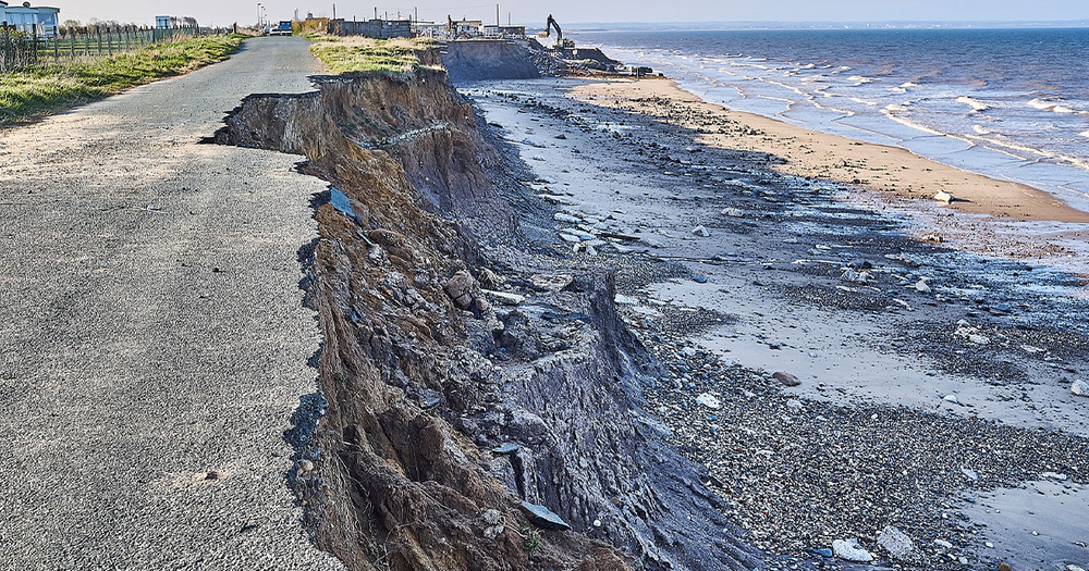
One of the greatest impacts of climate change on land surveying are rising sea levels. As they continue to rise, coastal areas are at an ever-increasing risk of flooding and erosion. While NASA keeps track of sea level change and its causes from space, surveyors are responsible for providing flood plain certificates to property owners in order to obtain things like flood insurance, Surveyors also establish national height networks and baselines and determining wetland boundaries.
This is especially crucial in coastal regions, where resettlement operations may ultimately prove necessary in the future. Land surveyors must take the observed rate of sea level rise into account when collecting data and mapping coastal areas.
Another impact of climate change on surveying operations is the change of frequency and intensity of extreme weather events. Hand-in-hand with rising global temperatures, there has been an increase of severe storms, floods, and droughts. Just as these severe and unexpected weather patterns may impact daily life for many, they also make it far more difficult for surveys to perform their duties.
Extreme weather events can cause significant damage to both the land and manmade infrastructure, impeding the surveyors’ ability to collect accurate data. In addition, extreme weather events can make it more difficult for surveyors to freely access different areas, leading to delays in data collection.
Climate change is also impacting the stability of the land itself. As temperatures rise, permafrost is melting, causing the ground to shift and sink in some areas with a colder climate. In addition, as rainfall patterns change and droughts become more frequent, the ground is becoming drier and more prone to subsidence.
The continued degradation of the ground has significant impacts on the viability of soil for agricultural purposes, as well as increasing the frequency of events like landslides and sinkholes. These changes to the land are added variables that make it harder for surveyors to collect accurate data, in addition to posing a risk to infrastructure and buildings.

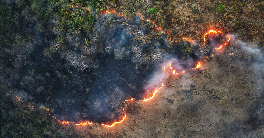
One of the most volatile impacts of climate change on land surveying is the increased risk of wildfire. Rising temperatures can make the climate of brush and forested areas more arid, making it easier for fires to catch and spread than in past years.
This has led to an increased need for maintenance on lands which have become more susceptible to wildfire, though clearing debris and excess brush does not entirely negate these higher risks. Like other natural disasters, wildfires have a deep impact on the land and infrastructure that they come into contact with.
Severe damage to areas impacted by wildfire comes with an immediate need for land survey efforts. Scorched earth can make it difficult, at times impossible, to determine property boundaries, utilities, and geographical features that are crucial to the rebuilding of a community.
One of the key ways that land surveyors can adapt to the challenges posed by climate change is by incorporating new technologies into their work. For example, drones and LiDAR (light detection and ranging) equipment can be used to create detailed 3D models of the land and its features, allowing surveyors to quickly and easily collect data in areas that are difficult to access.
In addition, the use of GIS (geographic information system) and other mapping technologies can help surveyors to analyze and interpret complex topographical data, as well as make predictions about the future impacts of climate change on the land in a particular area.
Another technological advancement that has aided in the process of land surveying is the introduction of drones. When working in dangerous areas such as those impacted by extreme weather or wildfire, land survey drones make it possible for survey crews to obtain data through highly accurate images. This not only ensures that crew members remain safe in high-risk areas, but also helps to obtain data faster than possible through conventional methods.

Due to the vast amount of data related to the local environment, land, and institutions that land surveyors are able to collect, they are in a unique position to help develop risk management and contingency strategies. Using their GIS tools, surveyors can create models to predict potential disasters in a given area.
With these potential disaster scenarios in mind, surveyors can help to compose rapid response plans in the event of disasters such as flooding, wildfire, or severe winds and storms. Land surveyors also have a greater chance of implementing institutional changes to help mitigate or avoid future high-impact events made more likely by climate change.
Analyzing problem areas that are more susceptible to natural disasters can reveal points where actions can be taken to prevent greater damage. For example, finding areas along a river that are likely to be heavily impacted by heavy rain and flooding. With this information, surveyors can suggest strategies such as creating additional paths for excess water to travel without causing damage to the surrounding environment, infrastructure, and population.
In the case of brushy environments that have an increased risk spreading wildfire due to rising temperatures, surveyors can likewise offer solutions such as:
-Removing excess foliage
-Clearing larger swaths of land to create a buffer zone
-Identify the best evacuation routes for various scenarios
Land surveyors can also develop multi-step plans for recovery and redevelopment efforts after a disaster has passed. Laying out a process for clearing debris, identifying local property boundaries, locating damaged sections along utility lines in need of repair, and more can make local restoration far more efficient.
Even in the face of rising environmental risks, land surveyors along with the technological advancements available at hand are in a better position than ever to identify areas with a higher probability of disaster impact and offer solutions to mitigate those dangers.
Offsetting the significant environmental impact of climate change on land surveying efforts is no small task. To be as prepared as possible, it is important for surveyors to learn more about the technologies available to them, as well as methods that can help to both keep survey crews safe in the field and collect more useful data to prepare for future disasters.
Baseline Equipment serves field professionals everywhere by offering the best in survey equipment like GPS devices, mounts, and hand tools, as well as PPE (personal protective equipment) and first aid materials. Even better, Baseline offers a vast repository of educational resources on land surveying, field safety practices, gear essentials, storm cleanup, and much more.