
Land surveying is an essential aspect of urban planning and development. It involves the measurement and mapping of land and its features, including natural and man-made structures, to provide accurate data for the design and construction of buildings, infrastructure, and other developments. In recent years, the field of land surveying has been evolving rapidly, with new technologies and innovations playing a significant role in shaping the future of smart cities.

“Smart city” is definitely an alluring term, but too often calls to mind images of science fiction cityscapes, flying cars, and self-walking dogs. Simply put, smart cities are those which, through autonomous technology, collect and analyze complex data about the city’s usage, and use this data to make the city more efficient.
One of the most common ways that current smart city programs are able to use this data is to reduce traffic congestion through adapting how traffic light systems operate in a particular area. As smart city technologies advance, developers will be able to use this data to more efficiently lay out utility lines, plan future development, identify disaster risks, and more.
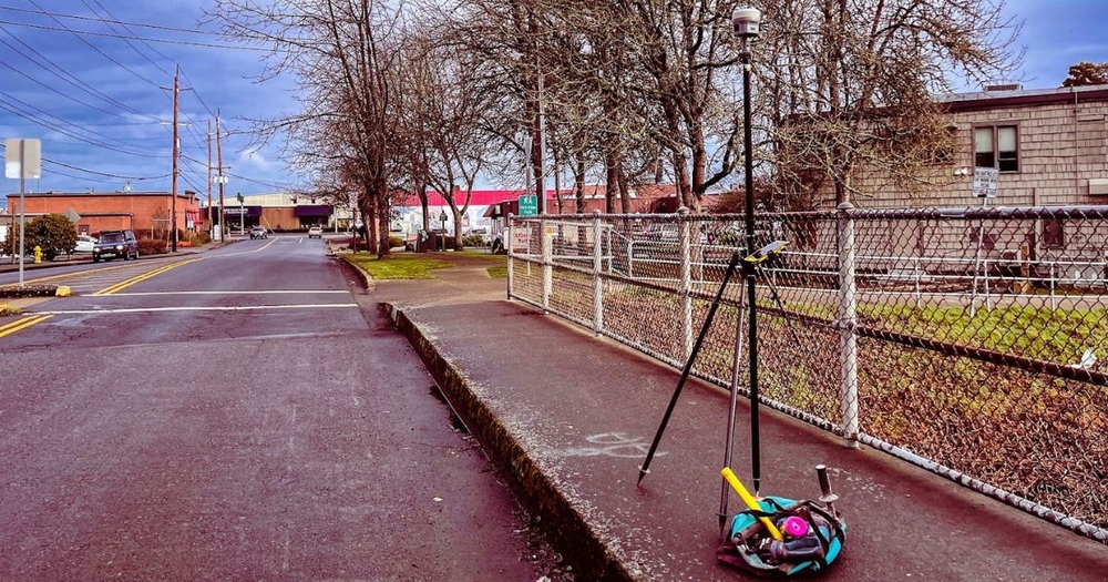
One of the most significant changes in land surveying is the increased use of technology, such as drones, robotic total stations, 3D laser scanning technologies like Light Detection and Ranging (LiDAR), and most importantly, the use of geospatial technologies. These technologies have greatly improved the accuracy and efficiency of land surveying, allowing surveyors to collect massive quantities of data quickly and easily.
Drones, for example, can be used to survey large areas of land, such as construction sites or urban areas, providing detailed images and data that would be difficult to collect manually. Robotic total stations, on the other hand, can be used to measure angles and distances with high precision, while 3D laser scanning can create detailed 3D models of buildings and structures.
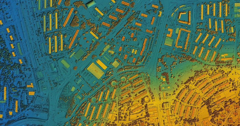
Geospatial technologies use geographic information systems (GIS), which function as computers that collect, analyze, store, and display geographic data. The use of these geospatial technologies has also enabled the creation of highly accurate digital replicas of a physical objects and environments, referred to as “digital twins.”
This technology allows for real-time monitoring and analysis of a city's infrastructure, providing valuable insights into how the city is functioning and where improvements can be made. As these technologies help surveyors to collect soaring masses of information about local environments, developing successful smart cities comes down to city planners being able to make use of this well of raw data.

Smart cities develop with the goal of adopting autonomous advanced technology to make energy use more efficient, as well as improving the efficiency and quality of city services like transportation and utilities.
Smart cities generate a huge amount of data, such as information on traffic patterns, energy consumption, and weather patterns. This data can be used to create detailed models of the city, which can help urban planners and developers make informed decisions about the design and development of the city.
For example, data on traffic patterns can be used to optimize the placement of traffic lights and roadways, while data on energy consumption can be used to identify areas where energy-efficient solutions can be implemented.
The use of virtual and augmented reality technology is also playing a significant role in land surveying and the development of smart cities. Virtual reality (VR) allows users to experience a city in 3D, while augmented reality (AR) overlays virtual information onto the real world.
This technology can be used to provide immersive experiences for city planners and developers, allowing them to visualize and test every aspect of different designs and layouts before development proceeds. It can also be used to provide information and assistance to citizens, such as providing real-time data on traffic and public transportation.
As this technology develops, citizens in the future can utilize these technologies to more easily find their way around the city, locate services, and connect with local groups and organizations.
One of the greatest examples of smart city development in recent years is the City Brain project by Alibaba Cloud. City Brain, which is active in dozens of cities such as Kuala Lumpur, aims to make the mass of data collected by AI and geospatial survey technology publicly available to the public.
According to the United Nation’s International Telecommunications Union, the ITU, Kuala Lumpur’s City Brain project aims to provide urban developers, universities, entrepreneurs and start-ups with the information and tools needed to come up with advancements independently. By making the large trove of data available to the public, independent researchers can devise new ways to use the data available in helpful ways.
Other cities that have implemented the City Brain, such as Alibaba’s hometown of Hangzhou, have seen significant improvements, with Alibaba stating that commutes were shortened and that first responders were able to halve their response times after two years of adoption.
Smart city technologies such as the City Brain will only continue to advance as time goes on, eventually making vast changes to how cities structure their roads, utilities, and placement of major hubs. A report from the McKinsey Global Institute suggest that as early as 2025, cities that utilize smart-mobility applications will see commute time reductions of up to 20% or more.
Easing traffic and congestion is just one way that data collected in land survey operations can be leveraged in the development of smart cities, but the potential for advancements in all other aspects of urban planning are limitless, especially in areas that allow for the open usage of city data.

The future of land surveying and smart cities are closely linked. As land survey technologies continue to grow and improve, the quality and usability of the data collected will improve with them. Survey data is already crucial to safely and efficiently designing cities and developing new areas, but in the near future could exponentially increase its impact.
The data collected which currently is utilized by smart city traffic systems will soon be seamlessly integrated with smart phones, autonomous vehicles (both for personal use and in use for public transportation). Congestion, accidents, and poor urban planning will become more and more rare.
This, in turn, will have a positive impact on the environment and the overall livability of the city. Without the significant advancements in measuring, data collection, and analytics put forward by the land surveying industry, none of these advancements would be possible.
For more information on land survey technologies, surveying tips, and crew equipment, be sure to look through the resources available from Baseline Equipment.